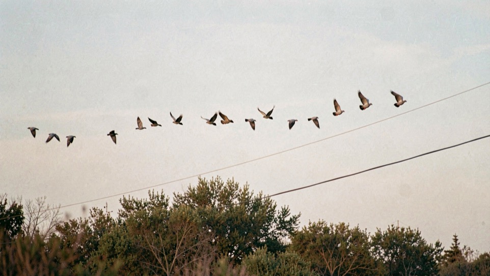
Standing in the brush country at first light, the birds appear to come from everywhere. They do not. A mourning dove spends its day moving between four things it cannot do without, and the routes between them harden into flight lines that are stable enough to be read from one morning to the next. The four are roost, feed, grit and water. Everything below is a consequence of that.
The four things a dove is travelling between
Doves roost in woody cover, usually in the taller mesquite or in whatever has a bit of height on a given place. They feed on open or nearly open ground, because a dove cannot scratch for seed the way a quail or a chicken can; it walks and picks, so the seed has to be lying accessible on bare or thinly vegetated soil. They swallow grit, which they find on caliche, on road margins and in pit edges. And in hot weather they drink, usually at least once a day. Roost, feed, grit, water. A flight line is simply the route between two of those points, chosen for being short and reasonably safe.
This is why a dove line so often runs along a fence, a sendero, a caliche road or a brush edge rather than straight across an open flat. The edge gives the bird a visual reference and a place to drop into if something goes wrong, and it usually happens to be the direct route anyway, because the roost and the feed are typically separated by a strip of brush with a road or a fence through it.
First light is not the same movement as mid morning
The early movement is roost to feed, and it is the one people picture. It is fast, low and fairly direct, and it happens over a compressed period. What follows is different: birds that have fed drift to grit and then to water, and the water movement in warm weather is generally a mid morning affair rather than a dawn one. That is a different line, often at a different height and to a different point of the compass, over the same ground.
The practical consequence is that describing a place as "good in the morning" is close to meaningless. A spot can sit on the feed line and be empty by the time the water line forms two hundred yards away. The habit worth building is to note the hour with the direction, every time, rather than the direction alone.
What bends a line
Wind bends it more than anything else. Doves land into the wind, so the approach to a feed field or a tank shifts with the wind direction, sometimes by ninety degrees between two days. Birds also use the lee of a brush line when the wind is up, dropping below the canopy top and following the sheltered side, which lowers them and shortens the distance at which they become visible.
Cover shapes the line too. A gap in a brush line, a low place, a gate, the point where two senderos meet: these funnel traffic in the same way a pass funnels traffic in a mountain range, and they do it consistently, because the shortest safe route across a barrier does not move when the birds change. Structure is the reason a good line is worth remembering from one year to the next, while a good field may not be.
What the birds are actually eating
In this country the seed sources are a mix of native forbs and agriculture. Croton, often called doveweed, is the classic native dove food of south Texas, and it comes up in disturbed ground: field edges, old plough scars, tracks, anywhere the soil has been broken. Sunflower and small grains carry the same weight where they are grown. What all of them have in common is that the seed ends up on the ground, accessible to a bird that walks and picks.
That is also why disturbed ground matters out of proportion to its area. A disked strip, a caliche pit, a burned patch or a road margin will hold birds that the surrounding intact brush will not, and the flight lines will point at it.
Where the law sits in all this
One point of regulation is worth knowing before any of the above becomes a plan, and it is a federal one. Dove hunting over bait is prohibited under the federal migratory bird regulations, while hunting over ground where a normal agricultural operation has taken place is treated differently. The boundary between the two is a legal question, not a folklore question, and the answer lives in the federal regulations and in the state summary that implements them, not in an article. How that regulatory chain is put together is set out in how a season date is made, and the publications themselves are listed on the sources page.
Reading a line without a bird in sight
Most of this can be worked out before the season, in the middle of the day, with nothing flying. Find the tallest woody cover and assume roost. Find the bare or broken ground and assume feed. Find the water. Find the caliche. Then look at what lies between those points: the gaps, the edges, the gates, the two tracks. The lines will be some subset of those connections, and the wind on the day will tell you which end of each one the birds will be approaching from.
The rest of this section takes the other two halves of the same country. Quail cover is about a bird that reads the same acre in the opposite way, and water holes is about the point where every line eventually converges. When the same reading has to be put on paper, drawing a piece of ground is the note on what a map of a place can hold.